OUR HALF DAY HIKES


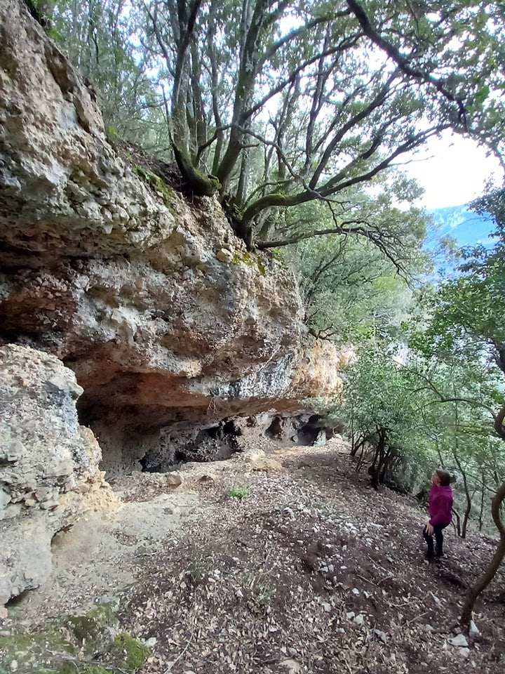


Hauteurs de St Martin Lys
This hike is rich in history. You will discover the former railway, before walking on a mule track zigzagging in the forest.
On top a remarkable point a view on Axat valley rewards your efforts ! A surprising cave is also on the way... On the way back we will go through the small village of St Martin Lys where you will learn more about his past and his famous priest.
This hike presents no big difficulty, the path has a gentle and regular slope (but rocky).


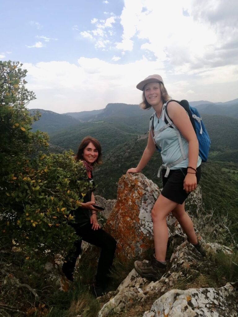
Nez de l’homme
This hike is taking you on the historical path that joined Quillan to the western plateau. It then goes in direction of the "nez de l'homme", a visible summit from the village that got his name from his nose shape.
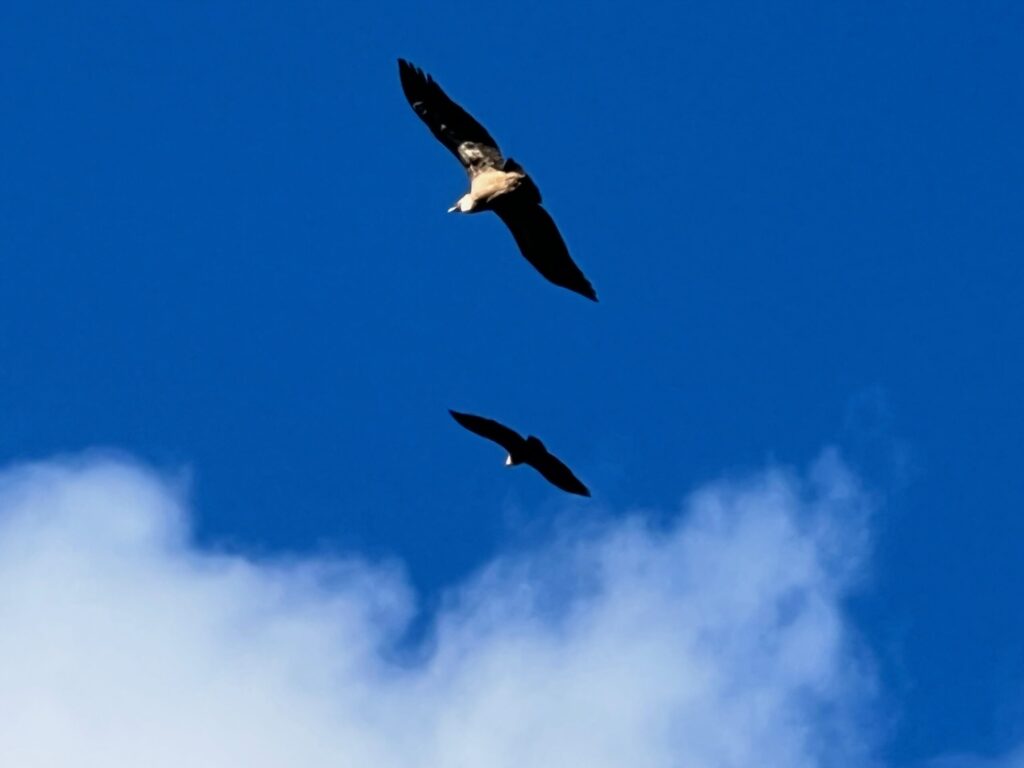
On top you will be surprised by the lapiaz limestone formations, enjoy a great panorama towards East (Quillan, Bitrague peak, Pierre Lys) and maybe see the griffon vultures often visible.
Taking a mule track to go back down to the village, we will observe in the woods remains of the agricultural past (ruined capitelle...).
This hike is not technically difficult, but the hike up is steep for a while and will warm up your calves !


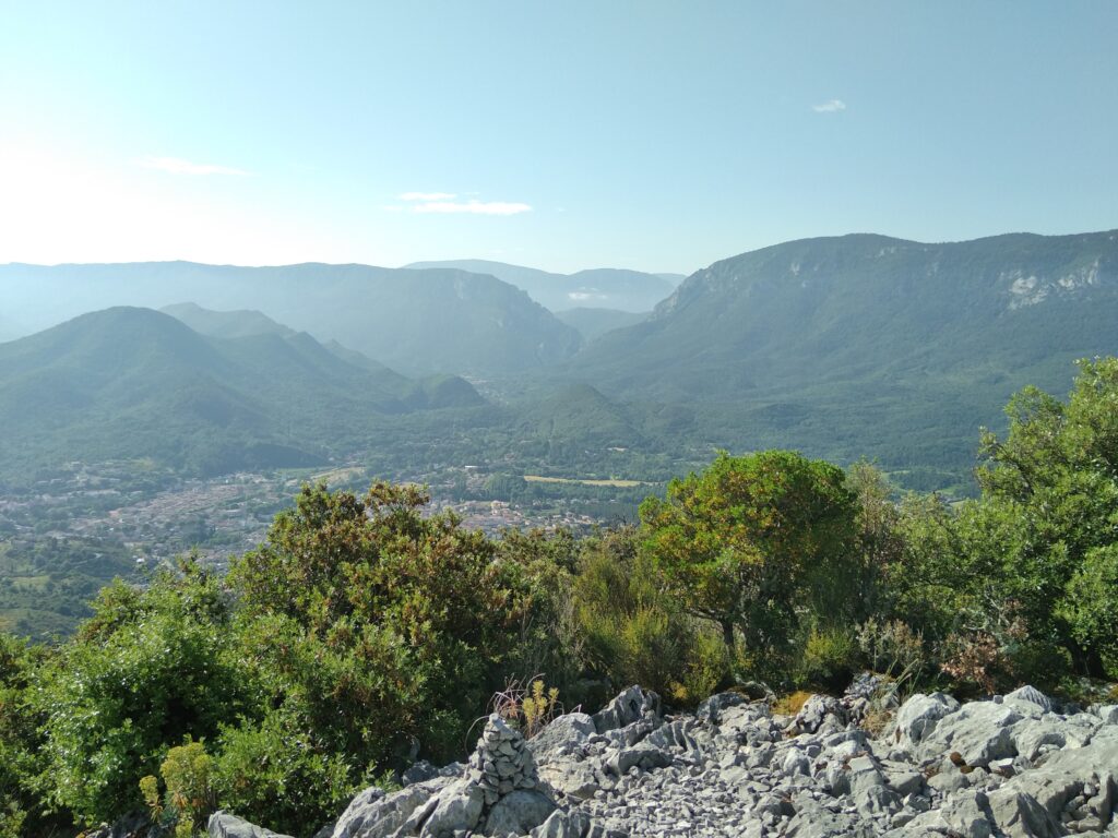
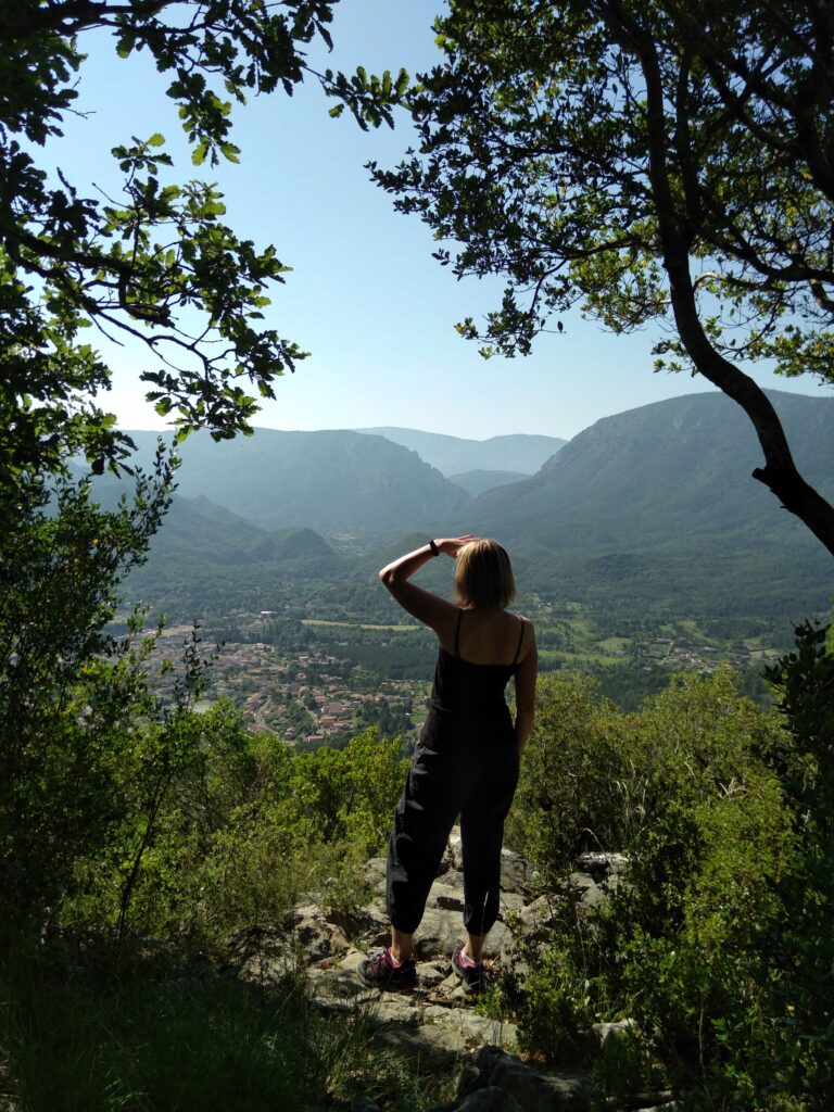
Autour d’Axat…
Departing from Axat we will first go along the river Aude where raftings enjoy the pleasures of wild water, before walking on a forest track with a gentle slope.
Next goal is to reach an impressive lookout over the St Georges gorges, where the view is simply... vertiginous !
The following part of the hike is tranquil and pleasant and takes us towards Artigues through the forest, before going back down to Axat where we might spot the famous "Train Rouge" or the vélorails that travel on the old railway.
This hike is classified as "Rather difficult" because the access to the lookout (linear stretch on a short distance) is difficult and technical : hike up and down very steep, rugged terrain, necessity to thread your way through the forest sometimes, vertiginous and impressive arrival at the lookout that requires caution. It's of course not mandatory to go up the lookout although it is one of the main attractions. Except from that, the hike is easy and accessible to anyone (gentle slope, large forest tracks).


Château de Puilaurens
This hike explores the forest tracks close to the Puilaurens castle, a Cathare fortress with a complete and well preserved defensive system. Perched on top of the mount Ardu (697 meters high), the castle reveals its splendour once you reach an overhanging lookout.
We will keep walking in the forest and you will learn about its growth cycle, the Scots pine logging, the use of touchwood mushroom, and even learn how to estimate a tree height.
This walk is very accessible and not technical, it travels most of the time on the wide forest track. Except for a 500m steep hike up to get to the stunning lookout, the elevation is low and the slope gentle.
After the hike, don't forget to visit the Puilaurens castle to get an insight from inside !


Gorges de St Jaume
Let's go discover the St Jaume gorges and the Fenouillet fortresses, which was once a powerful county and gave his name to the region: les Fenouillèdes.
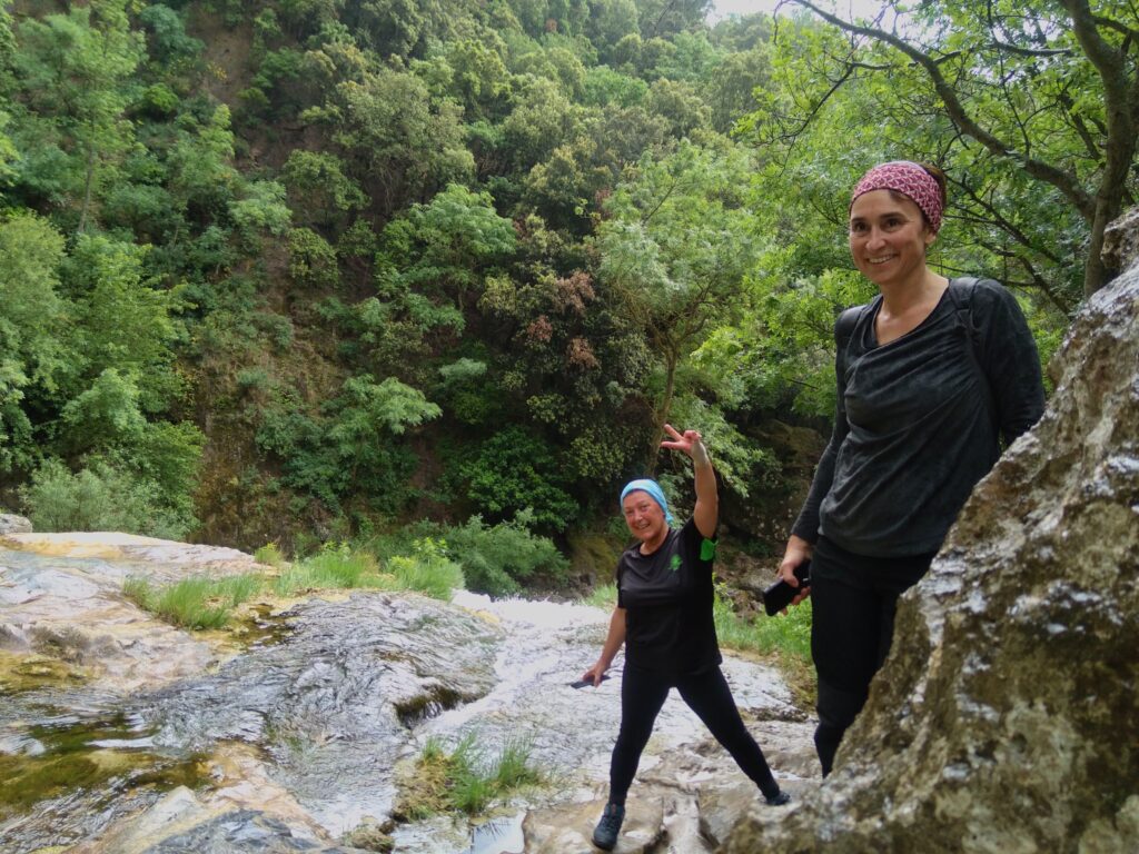
Crossing the beautiful gorges is great : passageways carved into the rock, narrow bridges, freshness of the creek...
At the la Villasse hamlet, we will go up the Fenouillet castle and the Sabarda tower, learn about their history and get some nice views !
Next the hike switches between pastoral and forest tracks, before going back down to the starting point and the beautiful church of Notre Dame de Laval.
This hike is quite easy and not technical, the stretch in the gorges is safe and protected, even if you are afraid of heights you should be able to go through it ! The walk takes place mostly on wide tracks with a gentle slope, the only steep stretches are to get to the castle and tower.


Arche de Maury
Our goal is the Maury arch, a natural rock arch that reveals only to the curious eyes... because it's invisible from the village. On the way up you can admire the views on the Canigou massif, the Quéribus castle and the vineyards on slaty soils.
Back from the hike, take some time in Maury wine tasting and looking at the trompe l'oeil on the facades.
Some steep ups and downs are waiting for you, but nothing insurmountable ! Wear long pants because the local fauna is scratchy...


Termes et son canyon
Termes is a lost and charming village in the Corbières with picturesque alleys.
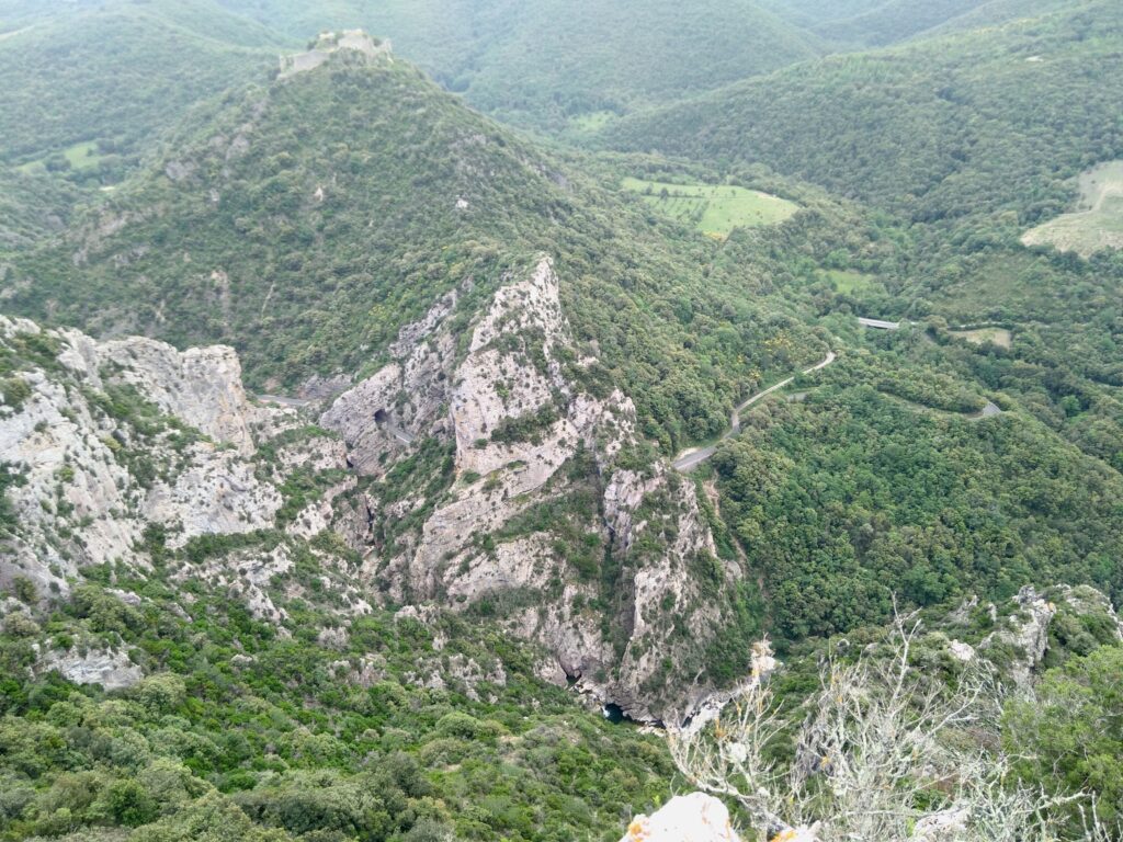
Going up you will get amazing lookouts on the medieval castle (well known to have resisted during the albigensian crusade in 1210) and on the Termenet gorges. These gorges are 400m deep and they show the geological turmoil caused by the Pyrenees' formation.
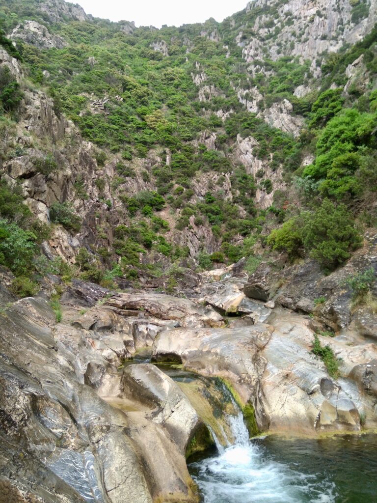
The descent will take you at the exit of this majestueux canyon, where a refreshing waterfall is waiting for you.
After the hike you can visit the Termes castle if you want to learn more about his history. And if you are a thrill seeker and want to see the gorges from closer, try canyoning.
This hike has some steep ups and downs, but the superb walk along the crest will reward your efforts !
I want to book my hike !
Precise the name of the hike, the desired date, the number of participants (age of kids if there are some...)
NECESSARY GEAR
– Good hiking shoes
– Hiking outfit adapted to weather conditions (waterproof and windproof clothing, cap...)
– Backpack with enough water and snacks
(cereal bars...)
OUR RATES
– Walk : 16 €
– Half day hike : 22 €
– Full day hike : 40 €
– Hike & camp initiation : 50 €*
– Hike & camp (2 days / 1 night) : 100 €*
* The camping gear hire is included.
** Family rate (2 adults + 2 kids) : 10% discount
Specify it in the booking form 🙂
GENERAL INFORMATION
You can use our contact form to ask for a booking (minimum 24h before the beginning of the service you want).
A minimum of 2 persons is required to book a hike.
The payement takes place on site (no online payement). Accepted means of paiement : credit card, bank transfer, cash.
Cathar Rando can accept or not your booking request, cancel or modify a service (bad weather conditions...). To learn more, visit our Terms and conditions available in the footer.
The hikes shown on the website are only a small glimpse of all the possibilities offered by the region ! If you would like to go on another hike, don't hesitate to contact us.