OUR FULL DAY HIKES


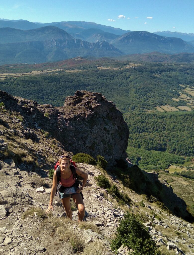
Les 3 quilles de Quillan
This full day hike is perfect to discover the city of Quillan and is climbing up to the "3 quilles", the mountains that gave the village's name.
You will learn more about the history and the industrial stages of Quillan (blacksmith shop, transporting logs on the river, Formica...) before reaching the castle that was built in the 12th century.
There starts the ascent to Bitrague's peak, the highest of the "3 quilles". You might get there a bit short of breath but with an incredible view on Quillan. The trail then runs along the crest for a long while and allows you to truly enjoy the amazing panoramas around !
Next step is to go back down and join Cavirac, little village with narrow alleys, before looping back to Quillan on a peaceful and easy path along the river Aude.
This hike is classified as rather difficult because the hike up to Bitrague's peak is quite long and steep (almost 400m positive elevation on a 3 kms distance) and some tracks on the crest are a little technical (narrow, rocky, steep).


Tour de Bugarach
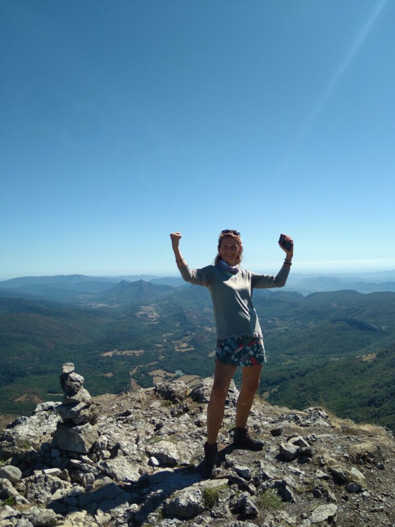
Bugarach is the highest peak of the Corbières region (1230m) and you will be charmed by the beauty of the panorama at the summit, but not only !
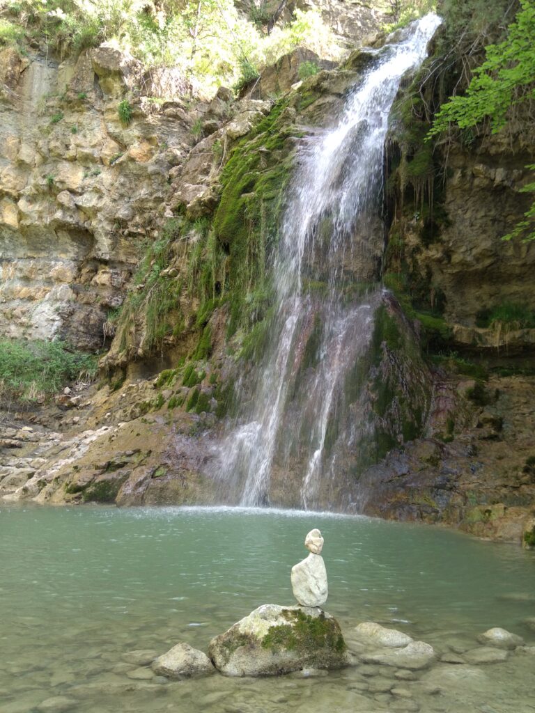
During this hike, you will among other things discover : the small village of Bugarach and the numerous legends about the place (UFOs, protection from the end of the world...), the famous and steep "window" way, the refreshing Mathieux waterfall, the geological particularities of the mountain... And of course the beautiful landscapes and maybe the local wildlife (pyrenean chamois, griffon vulture...).
This hike is dedicated to sportive participants (important elevation) that are not afraid of heights (some steep and rocky stretches where hands are necessary). The weather must be good to reach the summit : it can be unreachable by rainy, foggy or windy weather so choose wisely your day ! Alternative routes are possible around in case of bad weather at the summit.


Forêt d’en Malo
This hike takes you on a wide altitude plateau, in the heart of the imposing en Malo forest that hides many chasms (some of them are 200m deep !).
We will walk on various paths going from the mediterranean garrigue to shady fir forests, and then take a narrow and fairy track : going up in the forest and following the edge of the cliffs, it reveals progressively some incredible views around.
Arriving at the grassy plateau of Pla d'estable means it's the highest point of the hike (1440m) and time to take a break and enjoy the full panorama on Pierre Lys gorges, Bugarach peak, Puilaurens castle, Corbières... Stunning !
This hike requires to be sportive enough because the elevation is important, it goes up ! The track along the cliffs can seem impressive for those afraid of heights, but it's reassuring and never vertiginous. The hike back down to the village is on a rocky path but apart from that, this hike is not very technical.


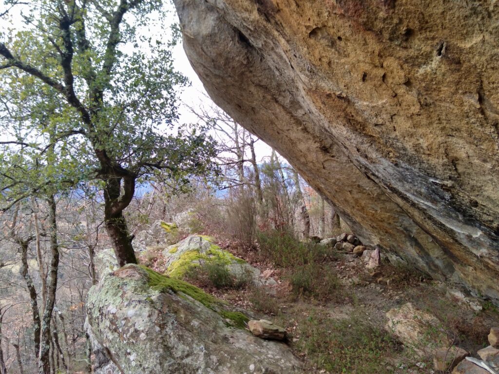


Plateau du Lauzet
During this full day hike we will be discovering the Lauzet plateau, a wide area swept by winds and dotted with rocky outcrops.
What's planned : walking on paths surrounded by holm oaks, views on Bugarach and Rennes le Chateau, 360° panorama from la Pique de Lavaldieu, hiking up to a rocky site with surprising geological formations, aven Paris... The landscapes are diversified and the legends numerous, you won't be bored !
This hike is quite long (17 kms) but isn't technically difficult. The elevation is progressive most of the time, yet two stretches uphill are waiting for you. The path can be muddy in some places in case of damp weather, but it allows us to look at animal tracks !
If you still have energy after the hike, don't miss the visit of the world-famous village of Rennes le Château, full of treasure legends and history...
I want to book my hike !
Precise the name of the hike, the desired date, the number of participants (age of kids if there are some...)
GENERAL INFORMATION
You can use our contact form to ask for a booking (minimum 24h before the beginning of the service you want).
A minimum of 2 persons is required to book a hike.
The payement takes place on site (no online payement). Accepted means of paiement : credit card, bank transfer, cash.
Cathar Rando can accept or not your booking request, cancel or modify a service (bad weather conditions...). To learn more, visit our Terms and conditions available in the footer.
The hikes shown on the website are only a small glimpse of all the possibilities offered by the region ! If you would like to go on another hike, don't hesitate to contact us.